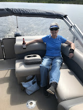

We’re still neophytes at boating the Colorado River but we’ve made some interesting observations on our two short forays. Most boats using the river in this section are of three basic types: inboard fiberglass go-fast, party barge pontoon style, or the flat-floor bass fishing boats. Nowhere does one see the larger cabin cruisers with deep V drafts. This mighty river, amazingly, is just too shallow for that! Aluminum boats like ours are such a rarity (we saw none) that we were amused to find everyone waving to us as they passed until we were driving out the first time and happened to pass a sheriff pulling his official boat—exactly just about like ours! We figure everyone was initialing mistaking us for the police so that was certainly a moment for hilarity!
As mentioned in my previous post, it appears as though the river level can fluctuate daily; enough so that it would be beneficial if we can come across some website that might make mention of the dam releases in terms of water flow and also when they may be planned. *Later update; I did find a Bureau of Reclamation site which gives water flows historically by gage location and the flows seem to vary to make a difference of between one and three feet of water, with lowest levels usually occurring shortly after midnight and increasing throughout the day. The problem becomes anticipating what days in the future will have the higher flows or conversely, if one wants to just hang out on a sandbar, which will have the low flows.
As you can tell from some of these pictures, the sand bars are not always above water to visually make note of, so the driver has to constantly stay on the alert. The first picture will give you a good idea; the river up to the point of the sandbar is running about 9-10 feet deep when suddenly it shoals quickly to 1.5 feet! Surprisingly too, most of the sandbars are in the middle of the river, not along shorelines; some even crossing the entire width of the river save for maybe 15 feet out from both banks, necessitating single file boating in those sections. We often have to jump sides when one side gets too shallow for comfort. Our depth/fish finder has never been so important a tool. This is definitely not hit the throttle and go type boating as we could enjoy in Coos Bay’s 35-50 feet depths.


Our latest trip out had us doing a little exploring in what are known as the backwaters of this labyrinth water system. The reeds and elephant grass along the main shorelines hide the fact that there are numerous other bodies of water paralleling the main channel. Some of these we found are actually large ponds and lakes which on Monday we had entirely to ourselves. The channels wind in narrow passages and with our motor tipped up and running just barely above idle, they were a fascination to explore. In one in particular we marked, Marc noted many schools of fish; more than likely crappie. Exploring these back waters and lying there at anchor in total quietude will probably become one of our favorite pastimes. We’ll be back out there again as soon as we can get the parts for the boat repair!