And the road goes on forever...

Wednesday, November 30, 2011

Tumco Mine Ghost Town


On our last day and night over Thanksgiving, we happened upon a desert pebble shelf providing boondocking with other RVers. Sitting a short distance above, sat the 1890’s boomtown and mine of Hedges, later renamed Tumco. It is now a historic and protected site of the Pichaco Recreation Area but run by the BLM on the far eastern border of California just north of I-8. Stated to be one of the earliest gold mining towns in California there is very little that remains of the once-bustling town of over 500 which sported residences, a hospital, two cemeteries, and saloons.


Early in the morning’s best light it was an interesting walk-around. I took time to photograph mementoes of an earlier life and time in what was a very inhospitable area. The miners worked for between $2-3.50 a day but since the homes they built sat on company land, they owed a monthly stipend for rental of the site. The gold was mined via use of cyanide and the waste was deposited into large cylindrical metal sediment pools. Once the mine closed, those were abandoned with their contents intact, lying in forlorn solidified heaps and lumps. Much of the town site is overrun with the ooze of these sediments and weather has made interesting patterns of what now looks like a volcanic ash flow.


It’s always an intrigue for me to wander through evidence of times past and wonder about those who trod this soil before me. One can imagine the noise and constant dust from the mine and living in such close proximity; it was mere footsteps out one’s door to go to work. There wasn’t much around these parts during those times—a small settlement at Yuma, 30 miles and a day away. The Southern Pacific RR punched their line through in 1877 which completed the line from Yuma to Los Angeles and which initially spurred the activity here since it is within two miles of the mine. Mining finally came to an end in 1942 with WWII and in 1949 the last residents wandered away and left Tumco a ghost town.


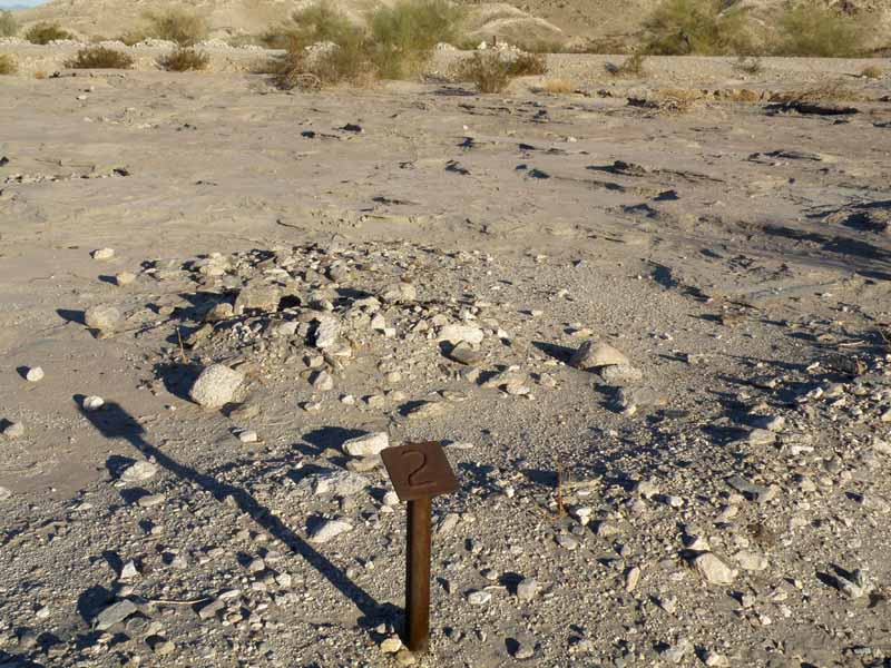
There is more of the mine area to explore when we return and Marc can go along with me. There is an information kiosk in the parking area with brochure pages giving the history of the site. It’s a short jaunt from Yuma at the Olgilby Rd exit north off I-8 and there are signs denoting its location. The numbered walking tour of the ruins is about 1.5 miles and is not a strenuous hike; vehicles are not allowed on mine property. For rock hounders, the area is also full of unusual minerals of note in the boondocking area, there for the picking.

Tuesday, November 29, 2011

Anza Borrego Trip, Part 2


Coachwhip Canyon
Given no hiking into the badlands due to the distance from us, we opt to go back to and across the highway, north to something designated “Coachwhip Canyon” which starts as a wide sandy wash from the highway. About a half mile in we pass a Class C getting set up in a wonderfully secluded spot hugging the cliffs and make note of it for our future use. We could reach this with the Dodge, but not the Freightliner due to all the sand. We slog northward, gradually gaining probably 500 feet in elevation during the course of our hike which takes us finally into the bowels of a slot canyon which snakes back and forth upon itself. Unlike the slot canyons of Utah, it is similar in character but not of rock as the topography here is eroded sandstone clay which mimics adobe. After a few miles, Marc has had enough so we turn around, losing hope this was a loop trail.


Salton Sea
We have one more night and two days so after a leisurely breakfast and start from Arroyo Salado we leave the park and head for the Salton Sea, about ten miles away. We are amazed at all the RVs parked along cliff tops overlooking canyons brimming with ATVs and dirt bikes. It’s like a festival with all the wagons circled as friends gather together amidst the rising dust. An intriguing spot for the far-off vista and lake views and canyon topography, but definitely not for us with all the hubbub and commotion. We keep going towards Brawley where we intend to then head east on Hwy. 78.


Imperial Sand Dunes
We happen upon the sand dunes almost by accident, noticing a constant stream of RVs in oncoming traffic. Soon we see a rest stop up a sand dune beckoning us to pull over. It’s a good thing too; we have a chance to exam the damage the rough roads have done to the rig—springing open cabinet doors and spewing contents and broken glass all over, including a liberal dose of sugar which now coats the entire kitchen and floor. Once again we marvel at the sheer number of large and expensive RVs and toys gathered in one ten mile segment—their numbers in the many thousands and thousands! All manner of sand toys dot the dunes like black ants in the distance and there is the constant hum of big machines roaring. It is truly a sight worth seeing at least once.


Tumco Mine Site
After a lunch stop to mop up the sugar damage, we turn south on Olgilby Road knowing we must find our last stop in the next 24 miles, when the road will then rejoin I-8. After a couple of false starts we happen across a few rigs parked on a desert pebble plain below the jagged Cargo Muchacho Mountains and a mine labeled Tumco Historic Mine. We pull in and find our own patch of gravel and settle in for indoor relaxation playing Mexican Train, as it has become fairly windy outside. Early the next morning I go mine exploring on my own but that story deserves its own blog so will follow this episode at a later date. We do find this spot much to our liking and figure that at less than forty miles from home it will make a good stay deserving of another visit. We are back home by noon and within a couple hours, the laundry is done, and the trailer is restocked, cleaned and ready for its next foray. Now we’ll know where to head back to for deeper exploration.


Just the Facts
Anza Borrego is little known considering its size. With free camping up to fourteen days, it merits serious consideration but be aware that you will also be competing with ATV usage in some areas. The visitor brochure lists twenty hiking trails but some, such as the slot canyon wash hike we did, aren’t even listed. There are two major badlands areas and some other areas of physical interest but most require four wheel drive. Dispersed camping is allowed throughout the park and there are also six campgrounds which charge $15-35 with some hookups. There are another eight backcountry campgrounds such as Arroyo Salado with no water and a vault toilet only and (usually) rough access. In a new twist to me (probably a California thing given the state’s abysmal budget status) you must BYOT (bring your own toilet tissue) when you visit the vaulted toilets.

This area gets less than 5 inches of rain a year and remains very hot June through September and even averages 90 during October so obviously winter is high season. We never felt crowded anywhere in the park despite the holiday however. I would imagine a weekday visitation would give a person miles and miles of empty spaces to explore. Apparently heavy rain years bring outstanding wildflower viewing in spring. The major town in proximity to the park is Borrego Springs with a population of about 3000. We didn’t see much in the way of restaurants (no fast food) nor shopping there, save for one small local grocery, a liquor store and an auto repair. But then, this isn’t the place to come if one is looking for town life.

Bring a four wheel drive vehicle if you can. Without it, much of the park will be off-limits. It’s not that the roads are necessarily so rough, but most sport deep, deep sand in spots.

Anza Borrego Here We Come, Part 1


We seem to be awakened half the night by the railroad crossing, where the mighty beast flashes by at 60 mph and any late night wayward traffic must come to a stop. We’re boondocking just down the road apiece from I-8 and Sidewinder Road on Wednesday night, the first night out with our new to us camper, on our way to explore Anza-Borrego State Park in southern California.

Anza-Borrego is huge (600,000+ acres); California’s largest state park and the only one to allow dispersed free camping. Those words being music to our ears, we head out on Thanksgiving morning as we normally do, not knowing where we’ll end up to spend the night. We’ve left without detailed maps of the area we plan to visit but I tell Marc I’m pretty sure we take the exit at Ocotillo, whose brown sign merely states “desert parks” and head north on Imperial Highway, a misnomer if I’ve ever seen one, as we traverse the narrow, shoulder-less, hilly road. We go through a border patrol checkpoint and then pull-over at a kiosk which features an area map—our only signal that we have entered the actual park; quite obviously via the back door.

After a brief pullover to take long distance photos of the Carrizo Badlands, with the wind blowing sand against our bare legs, we decide to head on and look for a more sheltered spot to settle into for the day and evening. Carrizo looks interesting but is definitely four wheel drive country.


Overland Stage Route
We find what we are looking for with a dirt track labeled Overland Stage Road 1849 which heads east and looks passable with the Freightliner. We stop some travelers coming back out the road and ask its condition and if there may be a place to camp and they helpfully point out that there is a spot by the trees and that the road is OK. Soon enough after a mere mile, we are able to pull off the road into a wide spot nestled in the scrub and Palo Verde trees. We set up camp; take a short sojourn up the dirt road and across the hills to find some monuments made out of rock (denoting the stage stop?), take in the views and then head back to prepare our Thanksgiving ham.


While in camp, Marc also worked on some dead Palo Verde walking sticks for both of us, which are a beautiful golden color.


Blair Valley
We head out bright and early the next morning continuing our meandering north on S2 which lends great morning light to the Blair Valley region of Borrego. There are signs of settlements here and there and we briefly exit the park then reenter upon intersecting Hwy. 78, a main artery from San Diego to the OHV Park at Salton Sea. Traffic picks up considerably (trucks and toy haulers) until we mercifully decide to exit back onto a smaller road which immediately starts up a twisty grade on its way to Borrego Springs, a town of about 3000 and the official Visitor’s Center and Museum. The Blair Valley side of Borrego is much lusher, higher in elevation and obviously gains more precipitation. Within view are farther western mountaintops sporting trees. Also populating this area are mile after hilly mile of closely packed Cholla cactus—those dreaded jumping demons that pose a threat to human and animal alike. This would be a tedious area to try camping with pets.


Box Canyon
Upon nearly reaching the summit we pull over at a historical sign for Box Canyon. There amidst the interesting flora is a winding pathway to the edge of a very small canyon with explanation that this was not only also part of the 1849 stage road, but it was originally hewn by the first emigrants to California, in 1847. The emigrants made the goat trail which sits just above the canyon bottom, which was used by the stagecoach.


Visitor Center
The state of California spent nearly $7 million dollars building the underground visitor center and gardens for Anza Borrego and it is a welcoming place which even let us take on water for our rig. While there, we finally were able to purchase good maps indicating mileage and highlights on all the back dirt roads for future trips. They maintain a pond and oasis for habitat for the highly endangered pupfish, a prehistoric fish native only to Death Valley.


Arroyo Salado
To wind up our day with a campsite, we heed words of advice and head on S22 towards the eastern boundary of the park where we find the very primitive Arroyo Salado campground. Marc again finds a spot we can back into and we’re glad we arrived early as it soon fills with tenters and ATVers. We are the only trailer in camp—the only one to venture down the rough road which would likely high center most normal trailers. We look out and down upon the Borrego Badlands—a more extensive area than the others we glimpsed the day before. There are trails into these as well, also accessed only via four wheel drive sand tracks. I’ll miss seeing them this trip as well.
To Be Continued....